The Charlie Thompson Walk Heritage Trail
This is one of the walks within the first batch of Heritage Walks created by Baildon History Society and commissioned by Baildon Parish Council.
The Charlie Thompson Walk
(Distance: about 1 mile, or 1.6 km.) This walk starts and finishes at St. John’s Court on Otley Road, Charlestown and covers the original heart of Charlestown, which was named after Charlie Thompson who built the first house here.
St John’s Court
St. John’s Court is a modern small shopping and residential area which was built in the late 1970s on the site of Victorian terraced housing: maps of the 1960s show St. John Street, which gives it its name, and also Alma Row and William Street. There are now four shops in this parade, and across Otley Road you will see Baxter’s butcher shop. There has always been a butcher in Charlestown, but there used to be many other shops too.
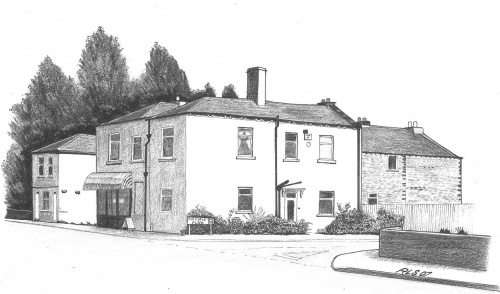
Across the road is Stone Street, where there was a large well which served much of Charlestown. Round the corner of the block which includes the butchers, at the top of Airedale Place, is a datestone ‘AD 1873’ and the initials ‘J.O’. This may be the initials of James Oddy who had his building plan for a house and shop approved by Baildon Local Board in May of that year. There was a grocer-cum-off-licence shop here on the corner until just a few years ago, and on the opposite corner at the top of Airedale Place was a Co-op which closed in the 1960s. The 1894 Post Office directory listed this as a branch of the Windhill Cop-operative Society. The new houses in Airedale Place were built by Consort Homes in 2000.
Behind St John’s Court
From the front of St. John’s Court, the Otley Road side, walk through to the back between Butterflies hair salon and the Fish and Chip shop. On the right are the remains of Union Street, which had appeared on maps by the middle of the nineteenth century.
Baildon Board approved the laying of water pipes from Low Baildon to Charlestown in 1862, and in 1863 the Local Government Board approved Baildon’s application to borrow and advertise in the Leeds Mercury for £1250 at 3¾% for Charlestown Sewerage Scheme. By October of that year property owners near the new sewer in Charlestown were connecting to it. It was almost 30 years later (1890) Baildon passed a plan for a water closet in Union Street. In September 1892 Baildon’s Medical Officer advocated more water closets in Baildon in view of the threat of cholera. The following summer the bellman (the town crier had not long before been equipped with a bell) was sent round Baildon warning against wasting water, under threat of prosecution. However the Board decided to allow one water closet to a house without charge for water.
In 1889 they asked Union Street owners for permission to pave and drain the street, apportioning the cost according to frontage, and this was done in 1892. Within living memory (1940s) there was a fish shop at the bottom of Union Street on Otley Road, and local residents also remember there being a pie and pea shop run from a house in William street.
Oxford Place
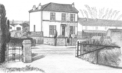
Walk to the end of the street to where Union Street meets Oxford Place. You will see on the corners two old houses which appear on maps by the 1840s, Ivy Garth on the left and Eldergarth on the right.
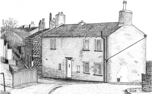
In 1914 Eldergarth was used for housing Belgian refugees. Germany invaded Belgium on the 4th of August 1914 and by the end of that month many refugees were arriving in England. Most seem to have gone to a reception centre set up at the Alexandra Palace in London, from where they were dispersed about the country. The West Riding placed 1,700 refugees, and many came to Bradford and Shipley, but Baildon had its own effort (it was a separate UDC within the West Riding in those days).
Mr John Metcalf, of Merlestead (which is on Ladderbanks Lane), owned a few houses in Charlestown and kindly offered the use of Eldergarth for a refugee family. It was furnished by ladies and gentlemen of the neighbourhood, and some people offered financial support. The Shipley Times and Express of October 30th reported that eight refugees from Malines were now in residence. They were two families, of a schoolmaster and a railway clerk, who married two sisters. Two boys attended Woodbottom School. Towards the end of that year two of the refugees took part in one of the local concerts in aid of the War Relief Fund. In the following year refugees were also being housed in several other houses in various parts of Baildon. Mrs Anderson of Ivy Lea, Fyfe Lane (see below), was very much involved in this work.
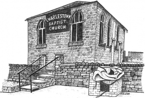
Turn right and walk along Oxford Place. In December 1891 Baildon Board of Health ordered houses in Oxford Place to connect their drains to Otley Road sewer. A little way along you will see the Charlestown Baptist Chapel on the right. This small chapel was opened in 1855 for Sunday School and services: apparently both were well attended. It served local people who had previously met in a local cottage, possibly Ivy Garth, as it has been said that there was a link between it and the chapel. The chapel was under the care of Bethel Chapel, Shipley, until it became independent in 1890. It is recorded that ‘The pulpit is mainly supplied by Rawdon students’, and it’s interesting that the Rawdon College of Ministers was established by the keen Baptist, the Rev. James Fyfe, after whose family Fyfe Lane and two other local streets are named. The chapel has recently closed (2009), but not for the first time: it reopened in 1964 after a spell of being used by a burler (removing knots from fibres or cloth) and mender – as recorded in the Shipley Directory of 1962.
Return along Oxford Place past Eldergarth and pause at the top of Union Street between Eldergarth and Ivy Garth. Both these houses have blocked up holes at ground level on their outside walls in Union Street where coal used to be delivered into the cellars. These would originally have had covers, which were usually made of wrought iron – some metal hinges can still be seen. Inside Ivy Garth there are vaulted cellars and the original tiled entrance floor. One living room has an old plastered ceiling with two thistles and two roses. The old word ‘garth’ means a yard, garden or enclosure.
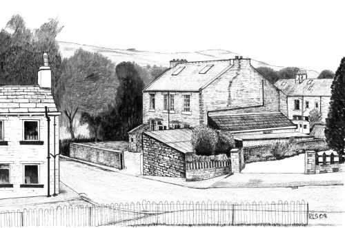
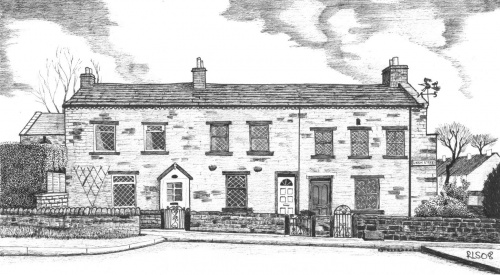
Then continue past Ivy Garth to Rosemont Lane. Across the street can be seen a pair of Victorian semis. These used to be known as Jessamine (No 20) and Ivy (22) Cottages and were at the top of what was then William Street, most of which was built in the 1890s. All of the other even-numbered houses in the street were back to back with houses in St John Street and have been demolished, but the remaining two were better quality ‘through’ houses and were left standing, though their address was changed to Oakroyd Terrace in 1980, along with the rest of William Street – the odd-numbered terraced houses opposite. No 21, at the top of the terrace, was first sold in 1897.
The top one of the pair (No 22) has a small stone building outside, at the top left corner of the street, which surviving deeds show was the wash-house for those two houses. (It may have served more of the houses in that street also.) The deeds of the two houses show that they each also had an outbuilding for ‘Ashes’, i.e., where the ashes from fires would be taken. Ashes were sometimes used for spreading on the pavement or road for easier and safer mobility in snowy and icy weather. A Baildon Local Board of Health regulation required that all ashpits be emptied by 9.00am, otherwise ‘proceedings would be taken’! Cottages usually had their own outbuilding which served as a privy. This was a lavatory which the night-soil men emptied in the days before the coming of the water closet (WC). The contents might be used for fertiliser.
Houses stored coal for the fire in a cellar or coal house. The coal house at No. 20 still exists as a stone outhouse attached to the house at the back. Inside No. 22 the high decorated ceilings are still extant, as is the tiny kitchen scullery where pots would be washed. The 1894 Post Office Directory records that a Mrs Sarah Montrose, laundress, was living in William Street at Charlestown, and also a schoolmaster called Mr Archibald Henry Anderson. (At some point he moved to Eldergarth, and later moved again to a new larger house in Fyfe Lane, as we shall see later.) Within living memory (1960s) every year on May 1st a chain was placed across the top of the street (it used to be Alma Row here) from the corner of the wash house – to prevent the dirt track leading up to Bankfield House farm (in what is now Dewhirst Road) becoming a public right of way.
The course of Barnsley Beck
Barnsley Beck used to flow past the top of the street, behind the wash-house, in its peculiar dog-leg course. It flowed under the Midland railway and came out where Mr Myers had a scrap car dismantling business. To the left of the beck was a steep bank which bordered a cricket field on Fyfe Lane. About a hundred yards down from Mr Myer’s establishment was a pig sty. Just past here the beck swung right, under a footbridge and behind this wash-house at the top of the street (Alma Row). In very severe rainfalls the beck would overflow and run down Union Street and form a ford over Otley Road. One resident remembers once having to bail the water out of the Virginia Cottage cellar by pouring it down the cellar sink. The main course flowed in front of Alan Goldsbrough’s home and behind the stable of Barnsley Cottage, then swung sharp left under (often flooding over!) Otley Road, and down past the Cemetery to the River Aire. However, this part of Barnsley Beck now flows underground in a conduit which passes through a (bricked up) cellar of Ivy Garth, and emerges into the River Aire at an outflow below Charlestown cemetery.
Dewhirst Road
Turn right and walk up past the pair of houses along Rosemont Lane, with the children’s play area on your right. Wild roses can still be seen near the big boulders at the top of the play area. You will reach Dewhirst Road and see Ivy Bank Court opposite. Dewhirst Close and Ivy Bank Court were built 1979-80. The road and close were named after Clifford Dewhirst who was a Baildon Labour councillor when Baildon had its own Urban District Council prior to 1974. He worked for the Co-op, which paid his election expenses and gave him time off if needed when he was Chairman of Baildon Council. Turn left on Dewhirst Road. Just before the road curves right you’ll see Bankfield House on the left. It is now two houses and was built on a field called Cow Hill Banks on the 1846 Tithe map. It used to be a farm house with a barn, pigs, hens, and a field for cows – on which Ivy Bank Court was built and which extended over part of where the allotments now are.
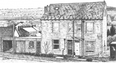
In the background of this drawing of Bankfield House is a row of houses with prominent chimney stacks – so reminiscent of the days of open coal fires. This is Oakroyd Terrace, previously called William Street (see above). The word ‘royd’ is an old local word often given to an area which has been cleared of woodland or trees, though what clearing this particular name refers to, and when, is a matter for speculation.
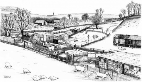
Those with young children may wish to go a little further up Dewhirst Road, for a view over allotments and semi-rural land, where various kinds of fowl and other livestock may still be seen.
Fyfe Lane
When you have spent long enough here, walk back along Dewhirst road until you reach the cross roads and turn left, up Fyfe Lane, named after the Fyfe family headed by the Reverend James Fyfe from central Scotland who settled in Shipley where he had become a lime and coal merchant by 1861. He married a local girl Mercy Rhodes who came from a well-off family. Her father John Rhodes was steward to the Earl of Rosse at the Old Hall in Shipley. James and Mercy Fyfe, whose gravestone can be seen in Charlestown cemetery – see Turnpike Walk, had eight children. The family owned land bordering Fyfe lane on the right hand side. In 1902 New Lane, as it was formerly known, was widened and renamed Fyfe Lane after the Fyfe family. It became the responsibility of the Baildon Urban District Council, which replaced the Baildon Local Board, in 1895. In an indenture (legal document ) of 30th September 1891 Mercy Fyfe, by then a widow, had agreed that John Rhodes Fyfe, her eldest son and Walter, another of her four sons, would be responsible for all sewer and street expenses in Fyfe Lane with rights of way allowed to the main Otley highway. In December 1892 Baildon Local Board minutes record that they decided to place another gas lamp in ‘Fyfe’s Lane’ (this was before the lane was officially renamed from New lane to Fyfe Lane). Gas was supplied by Shipley Gas Company which had laid gas pipes to Charlestown c1860. Up Fyfe Lane, pass the first of two entrances to Fyfe Crescent on the left. These houses were built on the old cricket field which once belonged to Baildon Primitive Methodist Church and then Butterfields before the Second World War when the team disbanded and then finally closed down with a cricket dinner in 1950. It has been said – by one elderly local resident whose father played for the cricket team and whose mother made the teas for them – that that final dinner was held at Baildon Cinema. W P Butterfield Ltd was an engineering firm on Otley Road which made tankers on the large site which was recently (2008) cleared for housing before the slump in the housing market.
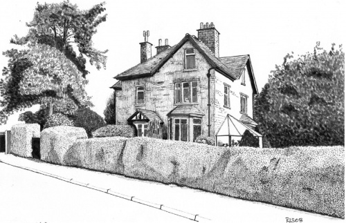
On the opposite side of Fyfe Lane stands Ivy Lea, the detached house with a large orchard garden behind the golden privet hedge. In 1934 Archibald Anderson, the schoolmaster who used to live in William Street and later moved to Eldergarth (see above), now headmaster at Woodbottom School, sold this house which he’d built on this double plot of land, bought in 1906 and 1907 from John Rhodes Fyfe and his brother Walter. The father of John Rhodes and Walter Fyfe was the Rev James Fyfe who supplied Baildon Local Board with limestone brought by barge from Craven for repairing the roads in the 1870s. William Fyfe also supplied the Board with Limestone. The firm J R Fyfe & Co, which made sanitary tubes and fire bricks, supplied the Board with pipes in the 1880s. In the first half of the twentieth century, from the early 1900s local builders built houses on the right hand side of Fyfe Lane, in Park Mount Avenue and at the beginning of Fyfe Grove (then a cul-de-sac). Ordnance Survey maps show Park Mount Avenue had been completed by 1922.
Back down to Otley Road
Now turn round and go back down Fyfe Lane. In clear weather you have good views across the valley to Idle Hill with the radio masts. When you get to Fyfe Grove, turn left and walk along until you reach Hoyle Court School grounds. Until the school and new houses were built in 1973, Fyfe Grove ended after the stone houses odd Nos 1-7 on the right, which were built in about 1920 by John Copley of the ropewalk family who bought land from the Fyfe family. The old field boundary wall then extended across the end of the Grove, and it can still be seen along the sides of the garden of No 9 and the school playground opposite. It goes right up past Ivy Lea (see above).

Return to Fyfe Lane and follow it down to the main Otley Road. Notice in passing Ivy Cottage near the bottom on the right. It appears on early maps at the middle of the nineteenth century, but has been substantially enlarged since first built, most recently following a fire in 1999. It was originally called Ada Cottage. Within living memory (1940s) there used to be a short row of small cottages on this side of Fyfe Lane at the top of the steep grass bank (at the lower end of where the line of cherry trees now are), and just below this is an interesting old stone set in the wall: it looks important but we don’t know what it was for.
On the opposite side of Fyfe Lane is a pair of semis called Mahim Crescent. They were built in the first half of the twentieth century by someone with a connection to Bombay where there is a Mahim Causeway after which they are named.
Otley Road
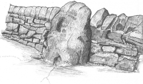
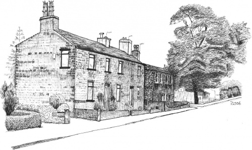
At the bottom of Fyfe Lane on the right hand corner is the cottage which is said to have been the first house to be built in Charlestown, after the new road, Otley Road, was built in about 1825. It is recorded by William Cudworth in Round about Bradford published in 1876 that when the residents met to decide on a name for the new hamlet which grew up on the ‘New Line’, as the new main road was nicknamed, they chose to name it Charlestown after the first resident Charlie Thompson who lived there and is said to have brewed beer in the cellar. The 1841 census records that Charles, now an innkeeper, and his wife had moved to the Fleece, the inn not far away in Otley Road now renamed the Half Way House. White’s directory records Hannah Thompson as the sole innkeeper there in 1853.
Across Otley Road is Acorn Park Industrial Estate with business units and at the bottom are the two large modern brick buildings built for Filtronic plc, the electronics firm started by Professor Rhodes which moved here from Shipley.
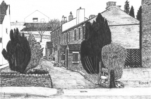
Turn right along Otley Road. You will pass the picturesque Ada Street on the right, another row of nineteenth century housing which appears on maps in the 1840s, but which escaped the 1970s redevelopment at St John’s Court.
On the opposite side of the main road you will see GTE Sylvania Ltd which manufactures and exports lighting products. The factory, which opened in 1981, was built between Otley Road and the River Aire on the site of the Charlestown Combing Company mill when industry was starting to expand further along Otley Road. Part of the Charlestown Combing Company site used to be a cricket field before it was all demolished in the 1970s. (There used to be another cricket field in Charlestown for a Charlestown cricket team. In the mid-nineteenth century it was down by the river in a field opposite St. James’s church.)
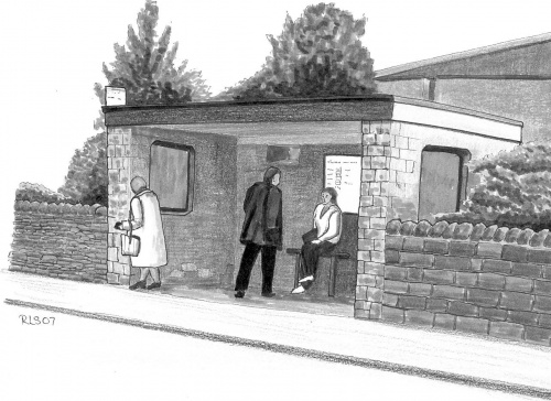
Sylvania also built the attractive stone bus shelter in front of the factory. They have now been bought by an Indian company and in the current volatile global financial crisis (October 2008) have announced their intention to close this factory and move production to India.
Continue along Otley Road to your starting point at St. John’s Court, and where this walk ends.
To return to the railway station retrace your steps up to the top of Fyfe Lane and cross the railway footbridge at the back of Park Mount Avenue. Turn right into Hawthorn View and cross Kirklands Road just above the railway bridge. Follow the snicket past some flats and enter Ridgewood Close. Follow that road to the station through the car park.
Note about distances
This is quite a short walk, but you may well find you walk much further than the indicated 1 mile (1.6 km.). Distances were measured from Google maps using their distance measuring tool in straight lines, but you are likely to wander here and there a bit. So regard the distance given as an approximate minimum.