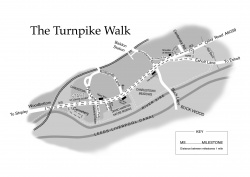
The Turnpike Walk Heritage Trail
This is one of the walks within the first batch of Heritage Walks created by Baildon History Society and commissioned by Baildon Parish Council.
The Turnpike Walk
(Distance: about 3 miles or 5 km.) This walk between the old turnpike milestones on the Otley Road (A6038) is in two legs, both starting at St John’s Court. The first goes to the railway arch at Woodbottom and back, taking in the peaceful Charlestown Cemetery; and the second goes to the old settlement of Tarn, at the foot of Hollins Hill and back. The Walk crosses Otley Road only twice, both at pedestrian crossings.
From St John’s Court to Woodbottom
There are many points of interest in and around the St John’s Court area, where you now are, but that is the subject of a separate Central Charlestown Walk (see list below). From St John’s Court turn right and walk along the main road towards the railway arch visible in the distance. Otley Road, built about 1825, was a Turnpike Trust Road, built for the Kirkstall, Otley and Shipley Trust who charged users a toll. The first toll point marked on old maps was at Baildon Bridge in Shipley, between the bridges over the canal and the river. It was the law that there had to be milestones on such roads every mile, and two remain on this stretch of road and our walk includes them both. You are now walking on the old turnpike road.

In 1848 a Public Health Act placed roads under local boards of health. Baildon had its own Local Board from 1852 and could levy a general rate, but by 1853 it had started to collect an additional local rate specifically for repairing the turnpike road. In October of that year Baildon Local Board of Health met and ordered that a rate of 6d (2½p) in the pound for repairs of the Turnpike Road be levied immediately, and £121 15s 2¼d (£121.76) was collected. By January 1856 the turnpike rate had increased to 10d, but the road was in a bad state of repair. The clerk of the Board was directed to see Messrs Swires and Blair, who were under a contract to keep the road in repair, and in April that year their contract for repairing the turnpike road was terminated. The Turnpike Trustees paid money from the tolls to the Board towards the upkeep of the road. The Trustees of the Kirkstall, Otley and Shipley Turnpike Trust held their last meeting in March 1871. By then their toll bars had been dismantled, and the toll houses and adjoining land sold.
Continue along the road until you come to Barnsley Cottage, opposite the cemetery gate. Barnsley Cottage is named after Barnsley Beck. The beck originally flowed from the moor through Kelcliffe, under Station Road and down through Charlestown to the River Aire. It crossed under the Otley Road at this point (often flooding it, well within living memory) and flowed down between the cemetery and Manor Paint into the River Aire. It now flows mostly underground, and emerges into the River Aire at the other end of the Cemetery.
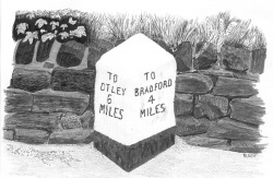
Beyond Barnsley Cottage are the allotments, on land previously occupied by Archway Nurseries. Opposite Manor Coating Systems, outside their car park on the other side of the road, is a turnpike trust milestone marking the distance in miles to Bradford (4) and Otley (6). (As we shall see, there is another still in existence, the next one – a mile up the road towards Otley on the same side of the road.) These milestones were erected by Turnpike Trust Companies.
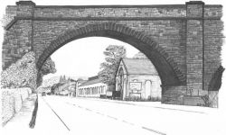
Now we come to what is said to mark the boundary of Charlestown – the railway arch which spans the road, the River Aire and another road on the far side of the river. Beyond it lies Woodbottom, with its parade of shops. The Midland Railway Company opened the branch line to Ilkley, with a station at Baildon, on December 4th 1876, with six trains a day in each direction. This viaduct has six masonry arches and one metal span of 110 feet.
Visit the notice board with information about the locality, situated between the car park and the bus stop. Then cross the Otley Road at the pedestrian crossing and turn left to begin the return of the first leg of this walk.
Heading back towards St John’s Court
Before you get to the viaduct and Arch Building Supplies, note a gap in the wall to your right beyond which is a small rectangular area of level ground before a sharp drop down to the river: here in the last century stood a veterans’ hut. A few steps further on a snicket leads down to a footbridge across the river where you can see more of the viaduct. Then return to Otley Road and go back under the viaduct.
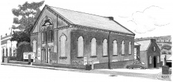
Just beyond the viaduct is the former Wesleyan Methodist Chapel. This was erected in 1870 as can be seen on the datestone. The total cost of £3000 was mostly paid for by Edward Holden. It seated 320 and survived as a church until 1970 and included the large stone school building at the rear. When it opened there were 18 teachers and officers for the Sunday School and 77 scholars. In 1880, at the centenary celebrations of the Sunday School movement held at Baildon Green, 1,602 children attended and 241 were from Charlestown Chapel. Only the Parish with its three mission churches had more. There were twelve Sunday schools in the Baildon area at that time. It’s recorded that in February 1877, the Baildon Local Board insisted the chapel buy their own water meter for working the organ by hydraulic pump (from Kennedy's Patent Water Meter Co. in Kilmarnock). It is now a carpet warehouse, but the interior still retains many features of the original church.
Charlestown Cemetery
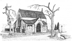
Immediately after the chapel, you pass Manor Coating Systems (previously Shipley Paint, and before that Bradford Dyers Association), on the far side of which is Charlestown Cemetery. It opened in 1863, and by 1893 there was a monumental mason called Jakeman close by on Otley Road, on the site of what is now Manor Coating Systems. His name can be found etched on many of the gravestones in the cemetery. The cemetery chapel is no longer open, alas.
To finance the purchase of the three acres of land and the building of the chapel, the Cemetery Company sold £10 shares. The whole cost including the chapel was £2,500. In March1897 Baildon Urban District Council (formerly Baildon Local Board) borrowed £500 from the Local Government Board and purchased the cemetery land and buildings for that amount from the Airedale Cemetery Company shareholders.
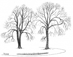
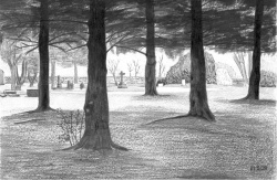
Previously a wooded area, it still retains a pleasant woodland feel, with many old mature broadleaves as well as more recently planted conifers and flowering cherries. There are a few seats provided, and it is a very peaceful place to spend a while. The River Aire flows past, though it can’t easily be reached from here.
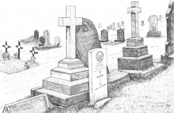
The cemetery contains the burials of fifteen servicemen from the two world wars. Eight of them are marked with the standard white War Grave stones.
Illustrated here is a First World War gravestone, of Private Pickles of the Canadian Infantry, standing in front of the family gravestone.
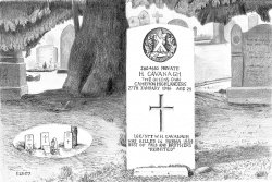
A World War II stone commemorates two members of the Cavanagh family.
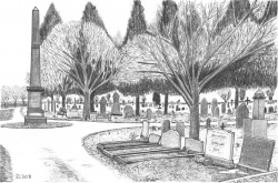
Also buried in marked graves are members of the Copley family who owned the ropeworks in Charlestown, including John Copley, who built houses in the Fyfe Lane area, and the Fyfe family after whom Fyfe Lane and other streets are named.
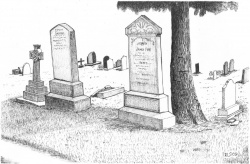
One business activity of the Fyfes was to provide the Baildon Board with stone for the roads. In April 1856 James Fyfe tendered at 2s 9d (14p) per ton for limestone and 2s 7d (13p) for road stones per ton of 22 cwt. Mr Fyfe’s tender was accepted. The responsibility for the repair of some roads rested with the adjacent private landowners. Following a complaint to the Board by Dr Lockley, in 1855 the Highways sub-committee was ordered to inspect the road from Low Baildon (as Station Road was formerly called) from William Ives’s (He was a farmer at Hole Top) to The New Line (as Otley Road was at first called). They reported that the portions belonging to the following were in a bad state: Mr Ambler and Mr Rand (who owned property at Hoyle and Kirklands respectively at the middle of the century), and Timothy Riley (Landowner at Brook Hill including land adjacent to Kirklands Road (then known as Slaughter Lane). They were to be told to repair them.
If you walk just past the tall obelisk in the middle of the ‘roundabout’ (see illustration above), with one of the seats on your left and facing the river, you will see a fallen ‘table-top’ tombstone. It belongs to the Whitfield family, who lost three children, which was not unusual in Victorian times. One of them was called Violetta, who died aged 12; and a black-edged ‘In Memoriam’ card – it was the custom then to send these round – contained these two verses:
She was a tender plant and fair,
Nursed with love and anxious care,
And every one her life did bless,
And admired her loviliness

She suffered long, but murmured not,
We watched her day by day,
With aching hearts grow less and less,
Until she passed away.
From Charlestown Cemetery to Buck Lane
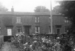
When you have spent enough time here, return to the Otley Road and turn right. Just beyond the Cemetery lodge, opposite Barnsley Cottage and Airedale Terrace, there used to be a row of cottages called Barnsley Buildings which backed onto the cemetery (see photo). Since they were demolished there has been a petrol filling station with car wash and second hand car sales on the site which went out of business in the 1990s when supermarkets started selling cheaper petrol. The new houses were erected on the site in the Millennium.
Continue on past these, and past St John’s Court where you began – distance so far is about 0.8 miles, or 1.3 km., or more if you spent much time in the cemetery – and cross over the road leading to the Acorn Park industrial estate. The first building past Acorn Park is Fern Cottage – where the ‘Pet Hotel’ kennels now are. Here, from the latter half of the nineteenth century there used to be the ropeworks of George Copley, rope and twine maker. In 1914 the ropewalk was powered by a 6hp gas engine.
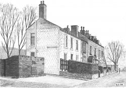
Continue along the road until, almost opposite the New Inn is a road called Briar Rhydding. The old word rhydding indicates that it was cleared (ridden) at some time in the past, presumably of prickly bushes such as wild roses. There used to be an orchard opposite the old stone houses down there, and in one of the houses Cecil Woodward lived in the 1940s and 50s when he searched and discovered many Mesolithic (middle stone age) microliths i.e., tiny flint arrow heads in Charlestown Meadows, the fields between the River Aire and further along Otley Road behind the Half Way House and towards Buck Lane. By the terrace of stone houses is a small block of privies and perhaps a wash house. A plan for water closets at the houses was approved by Baildon UDC in March 1906. At the bottom of Briar Rhydding is Baildon Timber, a family business owned by the Baildon family who are descended from the de Bayldon’s of Baildon Hall.
Further along Otley Road is DENSO Ltd. This is a group of firms with a Japanese parent. The first site before expansion on Otley Road was purchased in 1974 for Marston Radiators Ltd, which developed from a small tinsmith’s business making and repairing car radiators behind Leeds Town Hall in 1904 when cars were few, handmade and very expensive. It was taken over by Excelsior Radiator Company and made radiators for a range of cars including the Airedale before becoming part of ICI then IMI and later DENSO. It now makes engine cooling systems for vehicles including major car manufacturers across the world as well as for electric power generation. One of the benefits DENSO has conferred on the area is the creation of a nature reserve down by the river in 1991: the Riverside Walk leaflet takes you through it.
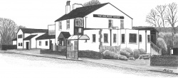
Beyond the Denso factory, opposite Kirklands Lane and the white wooden church called St James’s, you will see the Half Way House pub, which was previously called the Fleece – indeed, on the 1841 OS map it was the Golden Fleece! On the 1950 OS map it is the Fleece and on the 1960 OS map the Half Way House, so called because it is almost half way between Otley and Bradford as indicated by the second of the two old milestone which we shall see later at the bottom of Hollins Hill: Otley 5 miles, Bradford 5 miles. Inns along the route provided lodgings and stabling for the horses. In 1921 the Fleece Inn altered its stable into a garage. The Half Way House has been greatly enlarged in recent years particularly the restaurant, part of which was once a games room with dart board. A little past the pub on the right hand side there is a public footpath leading to the riverside footpath and the Denso Marston Nature Reserve.
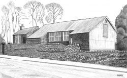
Walk on past the open ground on the right – this is an area called Charlestown Meadows – until you come to a small industrial complex on the right, just before you reach Buck Lane. The rather overgrown building nearest Otley Road, with the corrugated iron roof and shingle sides, was built as St James Mission Church in 1869 and seated 200. The name of St James was later applied to the white wooden church we have already passed. This area is described in more detail in the Riverside Walk which starts at this point and goes down Buck Lane to the River Aire. (Buck Lane marks the boundary of Charlestown.) A late elderly resident of what was reputedly the first cottage in Charlestown, who was also a member of the Copley family before marriage, remembered being told about a handloom weaver who walked from Buck lane all the way to Otley and back to sell his home-made piece of cloth.
From Buck Lane to Gill Beck
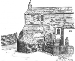
Cross over Buck Lane and continue until you come to Esholt Lane. Turn right into Esholt Lane until you come to a group of houses on the left. The area on this side of the road is called Tarn, and some of the first houses in the Tong Park area were built here and at Park on Park Lane for workers in nearby mills. Beyond a row of cottages is a detached house (Tarn Grange) which has a datestone 1827 at the back which can be seen easily from the pavement. From here also you have a good view of Bean House, isolated on its own opposite, appearing to be in the middle of a field! (Distance so far: about 1.8 miles, or 2.9 km.)
The lane leads on to the village of Esholt, of Emmerdale fame, but to follow the present walk turn back and take the public footpath back to Otley Road, between Tarn Grange and a row of cottages. There is a pedestrian crossing just to the left of where you rejoin the main road: cross here and turn right and walk past Hollins Hill Garage and car sales (not the filling station). There used to be a filling station and a garage here belonging to Sharp and Griffiths who claimed to be the first motor engineers in Baildon when the firm set up in a small stable opposite the Shoulder of Mutton pub in 1919. The building on this site was erected in the 1920s and later extended. The canopy from the old Windhill Station was brought here and erected over part of the garage forecourt, but that has now gone.
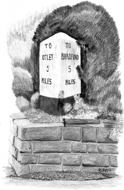
Continue past the car sales until you come to the second of the two turnpike milestones, this one half way between Bradford and Otley, but before returning to St John’s Court and seeing the additional points of interest on this side of the road, there are a couple more things to see further on.
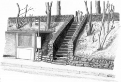
Continue on beyond the milestone, and cross the wide side road opposite the filling station. This used to lead to Denby’s Mill, and a little further on you come to a concrete bus shelter and Gill Steps, well worn by countless mill workers’ clogs as they made their way to and from work at that mill. Before being bought by the Denby family the mill at Tong Park was owned by a family named Gill. Several members of the family were trustees of the Kirkstall, Ilkley (and Otley) and Shipley Turnpike Trust. The mortgage book of the Turnpike Trust records that in 1826 three of the Gills, all worsted manufacturers of Baildon, advanced £700 for the road. The Trust built, extended and initially maintained the Turnpike Road. The Gills were entitled to a proportion of the tolls and interest amounted to 5% per annum.
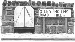
Continue along Otley Road until you come to Gill Beck flowing under the road. The beck is the boundary of Baildon, as indicated by the old boundary stone set against the wall marking the boundary between Baildon Urban District Council and Wharfedale Rural District Council which were abolished in 1974.
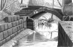
Behind the wall and the boundary stone, there are some stone remains of Clifton Mill which may be visible. You can just see the arch of an old bridge with some old culverts and other stoneworks behind it. Clifton Mill was originally a water-powered textile mill but has a chimney, indicating steam power, on the 1921 OS map, by which date it was disused. On the 1908 map it was a scouring plant. There was a mill pond to the east of Gill Beck and an L-shaped mill complex on the Baildon side.
On the opposite side of Otley Road and beside Gill Beck is an old mill. It is painted green and white and has a hoist (pulley) above a blocked up opening on the side facing the road. The side bordering the stream is stone and a long time ago it was an old corn mill powered by water from Gill Beck. There would then have been a water wheel. There is now a fencing business in the old buildings, but has been other things in its time, such as an engineering works, and not long ago it was a barkers (tanners). Tanning is the process of making raw hide into leather by soaking it in liquid using tannins found in bark. The business was (and is) owned by the Barker family of Esholt who ran it for one hundred and fifty years. In the large downstairs floor there was a big pit where hides were washed and upstairs there are still old photographs showing fleeces and hides hanging up. Adjacent is Naylor Brother MG car restorations and a car repair business. (Distance so far: about 2 miles or 3.2 km.)
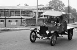
Otley Road has traditionally been a popular route for organised road events. On the Pennine Run historic vehicles including old buses and vintage steam lorries passed through Charlestown, to the joy of local enthusiasts – one recent historic vehicle rally was from Bradford to Morecambe on Sunday September 9th 2007 when about 106 vehicles took part. The world’s oldest amateur race-walking event also uses this route: on Spring Bank Holiday Monday 2008 the 106th Bradford Whit Walk took place. Hundreds used to participate and many spectators would line the route to encourage them on their round trip of 32 miles which included the long pull up Hollins Hill! The latest route covers 14 miles and stretches from Bradford to Ilkley.
From Gill Beck back to St John’s Court
Turn back here, past Hollins Hill Garage to the Shoulder of Mutton pub. Just before this pub, adjacent to its car park, is a group of new houses built at the millennium on the site of the old Tong Park School which was built in 1891. The school foundation stone can still be seen in the field just behind the houses: go through the pub car park, to the corner nearest the houses, and follow a tarmac path uphill to a gap in the wall into a small green field. The stone is set against the wall next to the new houses, about half way along.
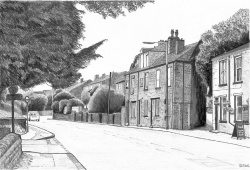
Return to Otley Road and turn right past the pub, noting the narrow gap between it and St James Place, which is the row of old houses on the main road. This is the old route from Esholt Lane which led up to Baildon. An 1841 map shows the Shoulder of Mutton inn at the side of this old route, and the road behind the St. James’s Place houses was then also called Esholt Lane. In 1890 Baildon Local Board granted licences for hackney carriages between the Shoulder of Mutton and Shipley for 2/6d each (12½p), drivers 1/- (one shilling, 5p). Some years later (1905) Baildon UDC decided to draw the attention of the police to the careless driving of motor cars along Otley Road where, in the previous year, the Council had decided against recommending a 10mph speed limit.
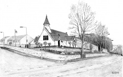
Continue along Otley Road and cross Roundwood Road (it’s usually safer if you walk a little way up the road before crossing). Walk on past Hoyle Court Road until you come to the white wooden St James Church, which has not always occupied its present site, nor even has it always been in Baildon. It came here from Great Warley in Essex. First consecrated in 1892 and dedicated to St. Mary, it was transported by steam traction engine and opened in 1905 in the middle of a small field. Recently it has moved again, from the centre of its field to the edge, to release land for houses to finance a major renovation. It closed on Easter Sunday 2007, and the building was modernised with meeting room, modern kitchen and toilet facilities which replaced the old church hall. There is also a ‘biblical garden’ of plants and trees mentioned in the Bible, including olive, fig and vine. It was re-opened in April 2008, and is now used for community purposes as well as church services. More information about St James’s, and the Kirklands and Hoyle Court areas above it, is provided in a separate leaflet on the Kirklands Walk.
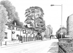
Further along Otley Road is the New Inn. This appears on the 1860 OS map but not the 1850 map or 1853 White’s Directory. This is where Cecil Woodward was born. His mother’s family were Yates and it is said they had the New Inn for up to a hundred years. Joseph Yates, a widower, was innkeeper there in 1881 with his three sons, three daughters and a grand-daughter. In the 1970s customers were served by a waiter. Prosperity since then has dipped for such establishments: this pub has recently re-opened after a short period of closure, whilst further along Otley Road at Woodbottom the Queens pub has Been converted into an Italian restaurant. This is in keeping with a current trend.
Continue on beyond the pub (possibly after refreshments), past Sycamore Court with the huge tree which gives it its name, and cross Fyfe Lane. Note in passing the picturesque C19th Ada Street, and thus return to your starting point at St John’s Court. (Total distance: about 3 miles, or 5 km.)
To return to the railway station retrace your steps up Fyfe Lane and cross the railway footbridge at the back of Park Mount Avenue. Turn right into Hawthorn View and cross Kirklands Road just above the railway bridge. Follow the snicket past some flats and enter Ridgewood Close. Follow that road to the station through the car park. It’s just over half a mile (0.9 km.).
